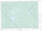
Maps showing Lac Antoine, Lac-Devenyns; Matawinie, Quebec
Lac Antoine is a Lake located in Lac-Devenyns; Matawinie, Quebec and has an elevation of 482 meters.
- Latitude: 47° 0' 48'' North (decimal: 47.0133756)
- Longitude: 73° 45' 22'' West (decimal: -73.7559729)
- Topography Feature Category: Lake
- Geographical Feature: Lac
- Canadian Province/Territory: Quebec
- Elevation: 482 meters
- Location: Lac-Devenyns; Matawinie
- Atlas of Canada Locator Map: Lac Antoine
- GPS Coordinate Locator Map: Lac Antoine Lat/Long
Lac Antoine NTS Map Sheets