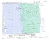
Maps showing Rivière Aquatuc, Chisasibi; Jamésie, Quebec
Rivière Aquatuc is a River located in Chisasibi; Jamésie, Quebec and has an elevation of 49 meters.
- Latitude: 53° 40' 28'' North (decimal: 53.6744444)
- Longitude: 78° 59' 50'' West (decimal: -78.9972222)
- Topography Feature Category: River
- Geographical Feature: Rivière
- Canadian Province/Territory: Quebec
- Elevation: 49 meters
- Location: Chisasibi; Jamésie
- Atlas of Canada Locator Map: Rivière Aquatuc
- GPS Coordinate Locator Map: Rivière Aquatuc Lat/Long
Rivière Aquatuc NTS Map Sheets