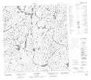
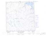
Maps showing Lac Arbot, Rivière-Koksoak; Kativik, Quebec
Lac Arbot is a Lake located in Rivière-Koksoak; Kativik, Quebec.
- Latitude: 61° 6' 39'' North (decimal: 61.1108246)
- Longitude: 72° 49' 48'' West (decimal: -72.8299501)
- Topography Feature Category: Lake
- Geographical Feature: Lac
- Canadian Province/Territory: Quebec
- Location: Rivière-Koksoak; Kativik
- Atlas of Canada Locator Map: Lac Arbot
- GPS Coordinate Locator Map: Lac Arbot Lat/Long
Lac Arbot NTS Map Sheets