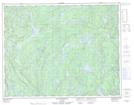
Maps showing Lac Arpin, Lac-Jérôme; Minganie, Quebec
Lac Arpin is a Lake located in Lac-Jérôme; Minganie, Quebec and has an elevation of 179 meters.
- Latitude: 50° 53' 17'' North (decimal: 50.8881246)
- Longitude: 62° 28' 25'' West (decimal: -62.4737110)
- Topography Feature Category: Lake
- Geographical Feature: Lac
- Canadian Province/Territory: Quebec
- Elevation: 179 meters
- Location: Lac-Jérôme; Minganie
- Atlas of Canada Locator Map: Lac Arpin
- GPS Coordinate Locator Map: Lac Arpin Lat/Long
Lac Arpin NTS Map Sheets