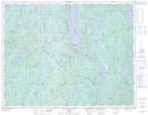
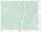
Maps showing Lac Arthur, Rivière-aux-Outardes; Manicouagan, Quebec
Lac Arthur is a Lake located in Rivière-aux-Outardes; Manicouagan, Quebec.
- Latitude: 50° 45' 11'' North (decimal: 50.7530906)
- Longitude: 68° 56' 22'' West (decimal: -68.9395121)
- Topography Feature Category: Lake
- Geographical Feature: Lac
- Canadian Province/Territory: Quebec
- Location: Rivière-aux-Outardes; Manicouagan
- GPS Coordinate Locator Map: Lac Arthur Lat/Long
Lac Arthur NTS Map Sheets