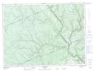
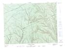
Maps showing Rivière Assemetquagan, Saint-André-de-Restigouche; Avignon, Quebec
Rivière Assemetquagan is a River located in Saint-André-de-Restigouche; Avignon, Quebec and has an elevation of 465 meters.
- Latitude: 48° 4' 45'' North (decimal: 48.0792164)
- Longitude: 67° 5' 50'' West (decimal: -67.0972001)
- Topography Feature Category: River
- Geographical Feature: Rivière
- Canadian Province/Territory: Quebec
- Elevation: 465 meters
- Location: Saint-André-de-Restigouche; Avignon
- Atlas of Canada Locator Map: Rivière Assemetquagan
- GPS Coordinate Locator Map: Rivière Assemetquagan Lat/Long
Rivière Assemetquagan NTS Map Sheets