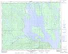
Maps showing Lac Aubertin, Rivière-Mouchalagane; Caniapiscau, Quebec
Lac Aubertin is a Lake located in Rivière-Mouchalagane; Caniapiscau, Quebec and has an elevation of 547 meters.
- Latitude: 51° 59' 48'' North (decimal: 51.9967360)
- Longitude: 67° 52' 53'' West (decimal: -67.8813542)
- Topography Feature Category: Lake
- Geographical Feature: Lac
- Canadian Province/Territory: Quebec
- Elevation: 547 meters
- Location: Rivière-Mouchalagane; Caniapiscau
- Atlas of Canada Locator Map: Lac Aubertin
- GPS Coordinate Locator Map: Lac Aubertin Lat/Long
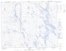
Lac Aubertin NTS Map Sheets