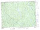
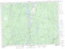
Maps showing Lac Aubuchon, Belle-Rivière; Lac-Saint-Jean-Est, Quebec
Lac Aubuchon is a Lake located in Belle-Rivière; Lac-Saint-Jean-Est, Quebec and has an elevation of 488 meters.
- Latitude: 47° 59' 59'' North (decimal: 47.9997222)
- Longitude: 72° 1' 17'' West (decimal: -72.0213889)
- Topography Feature Category: Lake
- Geographical Feature: Lac
- Canadian Province/Territory: Quebec
- Elevation: 488 meters
- Location: Belle-Rivière; Lac-Saint-Jean-Est
- Atlas of Canada Locator Map: Lac Aubuchon
- GPS Coordinate Locator Map: Lac Aubuchon Lat/Long
Lac Aubuchon NTS Map Sheets