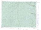
Maps showing Lac de l'Auge, Lac-Pikauba; Charlevoix, Quebec
Lac de l'Auge is a Lake located in Lac-Pikauba; Charlevoix, Quebec and has an elevation of 788 meters.
- Latitude: 47° 45' 4'' North (decimal: 47.7511111)
- Longitude: 70° 51' 30'' West (decimal: -70.8583333)
- Topography Feature Category: Lake
- Geographical Feature: Lac
- Canadian Province/Territory: Quebec
- Elevation: 788 meters
- Location: Lac-Pikauba; Charlevoix
- Atlas of Canada Locator Map: Lac de l'Auge
- GPS Coordinate Locator Map: Lac de l'Auge Lat/Long
Lac de l'Auge NTS Map Sheets