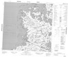
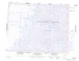
Maps showing Presqu'île Aulassivik, Baie-d'Hudson; Kativik, Quebec
Presqu'île Aulassivik is a Cape located in Baie-d'Hudson; Kativik, Quebec and has an elevation of 3 meters.
- Latitude: 59° 44' 30'' North (decimal: 59.7416666)
- Longitude: 77° 32' 29'' West (decimal: -77.5413888)
- Topography Feature Category: Cape
- Geographical Feature: Presqu'île
- Canadian Province/Territory: Quebec
- Elevation: 3 meters
- Location: Baie-d'Hudson; Kativik
- Atlas of Canada Locator Map: Presqu'île Aulassivik
- GPS Coordinate Locator Map: Presqu'île Aulassivik Lat/Long
Presqu'île Aulassivik NTS Map Sheets