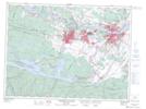
Maps showing Aéroport de Bagotville, Saguenay; Saguenay, Quebec
Aéroport de Bagotville is a Air navigation feature located in Saguenay; Saguenay, Quebec and has an elevation of 162 meters.
- Latitude: 48° 19' 57'' North (decimal: 48.3325)
- Longitude: 70° 59' 34'' West (decimal: -70.9927777)
- Topography Feature Category: Air navigation feature
- Geographical Feature: Aéroport
- Canadian Province/Territory: Quebec
- Elevation: 162 meters
- Location: Saguenay; Saguenay
- Atlas of Canada Locator Map: Aéroport de Bagotville
- GPS Coordinate Locator Map: Aéroport de Bagotville Lat/Long
Aéroport de Bagotville NTS Map Sheets