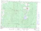
Maps showing Lac Baillairgé, La Corne; Abitibi, Quebec
Lac Baillairgé is a Lake located in La Corne; Abitibi, Quebec and has an elevation of 328 meters.
- Latitude: 48° 19' 32'' North (decimal: 48.3255556)
- Longitude: 77° 58' 16'' West (decimal: -77.9711111)
- Topography Feature Category: Lake
- Geographical Feature: Lac
- Canadian Province/Territory: Quebec
- Elevation: 328 meters
- Location: La Corne; Abitibi
- Atlas of Canada Locator Map: Lac Baillairgé
- GPS Coordinate Locator Map: Lac Baillairgé Lat/Long
Lac Baillairgé NTS Map Sheets