Maps showing Baie Barker, Rivière-Kipawa; Témiscamingue, Quebec
Baie Barker is a Bay located in Rivière-Kipawa; Témiscamingue, Quebec and has an elevation of 355 meters.
- Latitude: 47° 30' 20'' North (decimal: 47.5056366)
- Longitude: 77° 27' 18'' West (decimal: -77.4549990)
- Topography Feature Category: Bay
- Geographical Feature: Baie
- Canadian Province/Territory: Quebec
- Elevation: 355 meters
- Location: Rivière-Kipawa; Témiscamingue
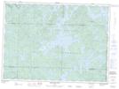
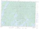
- Atlas of Canada Locator Map: Baie Barker
- GPS Coordinate Locator Map: Baie Barker Lat/Long
Baie Barker NTS Map Sheets