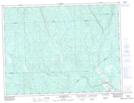
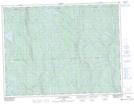
Maps showing Lac à Basile, Rivière-Mistassini; Maria-Chapdelaine, Quebec
Lac à Basile is a Lake located in Rivière-Mistassini; Maria-Chapdelaine, Quebec and has an elevation of 280 meters.
- Latitude: 49° 14' 44'' North (decimal: 49.2455556)
- Longitude: 72° 39' 30'' West (decimal: -72.6583333)
- Topography Feature Category: Lake
- Geographical Feature: Lac
- Canadian Province/Territory: Quebec
- Elevation: 280 meters
- Location: Rivière-Mistassini; Maria-Chapdelaine
- Atlas of Canada Locator Map: Lac à Basile
- GPS Coordinate Locator Map: Lac à Basile Lat/Long
Lac à Basile NTS Map Sheets