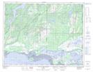
Maps showing Rivière Bat-le-Diable, Havre-Saint-Pierre; Minganie, Quebec
Rivière Bat-le-Diable is a River located in Havre-Saint-Pierre; Minganie, Quebec and has an elevation of 119 meters.
- Latitude: 50° 19' 48'' North (decimal: 50.3299999)
- Longitude: 63° 39' 25'' West (decimal: -63.6569444)
- Topography Feature Category: River
- Geographical Feature: Rivière
- Canadian Province/Territory: Quebec
- Elevation: 119 meters
- Location: Havre-Saint-Pierre; Minganie
- Atlas of Canada Locator Map: Rivière Bat-le-Diable
- GPS Coordinate Locator Map: Rivière Bat-le-Diable Lat/Long
Rivière Bat-le-Diable NTS Map Sheets