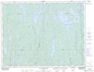
Maps showing Rivière Beavertail, Baie-James; Jamésie, Quebec
Rivière Beavertail is a River located in Baie-James; Jamésie, Quebec.
- Latitude: 49° 14' 30'' North (decimal: 49.2417335)
- Longitude: 74° 26' 22'' West (decimal: -74.4395764)
- Topography Feature Category: River
- Geographical Feature: Rivière
- Canadian Province/Territory: Quebec
- Location: Baie-James; Jamésie
- GPS Coordinate Locator Map: Rivière Beavertail Lat/Long
Rivière Beavertail NTS Map Sheets