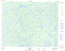
Maps showing Lac Béchard, Baie-James; Jamésie, Quebec
Lac Béchard is a Lake located in Baie-James; Jamésie, Quebec and has an elevation of 319 meters.
- Latitude: 51° 21' 47'' North (decimal: 51.3631496)
- Longitude: 75° 37' 56'' West (decimal: -75.6321583)
- Topography Feature Category: Lake
- Geographical Feature: Lac
- Canadian Province/Territory: Quebec
- Elevation: 319 meters
- Location: Baie-James; Jamésie
- Atlas of Canada Locator Map: Lac Béchard
- GPS Coordinate Locator Map: Lac Béchard Lat/Long
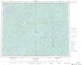
Lac Béchard NTS Map Sheets