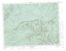
Maps showing Ruisseau Berry Nord, Lac-à-la-Croix; La Mitis, Quebec
Ruisseau Berry Nord is a River located in Lac-à-la-Croix; La Mitis, Quebec and has an elevation of 195 meters.
- Latitude: 48° 39' 50'' North (decimal: 48.6639356)
- Longitude: 66° 8' 9'' West (decimal: -66.1357804)
- Topography Feature Category: River
- Geographical Feature: Ruisseau
- Canadian Province/Territory: Quebec
- Elevation: 195 meters
- Location: Lac-à-la-Croix; La Mitis
- Atlas of Canada Locator Map: Ruisseau Berry Nord
- GPS Coordinate Locator Map: Ruisseau Berry Nord Lat/Long
Ruisseau Berry Nord NTS Map Sheets