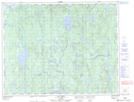
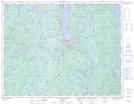
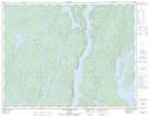
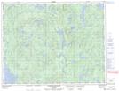
Maps showing Lac Berté, Rivière-aux-Outardes; Manicouagan, Quebec
Lac Berté is a Lake located in Rivière-aux-Outardes; Manicouagan, Quebec and has an elevation of 332 meters.
- Latitude: 50° 46' 40'' North (decimal: 50.7777737)
- Longitude: 68° 31' 28'' West (decimal: -68.5244737)
- Topography Feature Category: Lake
- Geographical Feature: Lac
- Canadian Province/Territory: Quebec
- Elevation: 332 meters
- Location: Rivière-aux-Outardes; Manicouagan
- Atlas of Canada Locator Map: Lac Berté
- GPS Coordinate Locator Map: Lac Berté Lat/Long
Lac Berté NTS Map Sheets