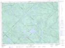
Maps showing Rivière des Bêtes Puantes, Lac-Normand; Mékinac, Quebec
Rivière des Bêtes Puantes is a River located in Lac-Normand; Mékinac, Quebec and has an elevation of 267 meters.
- Latitude: 46° 57' 46'' North (decimal: 46.9628095)
- Longitude: 72° 54' 30'' West (decimal: -72.9084534)
- Topography Feature Category: River
- Geographical Feature: Rivière
- Canadian Province/Territory: Quebec
- Elevation: 267 meters
- Location: Lac-Normand; Mékinac
- Atlas of Canada Locator Map: Rivière des Bêtes Puantes
- GPS Coordinate Locator Map: Rivière des Bêtes Puantes Lat/Long
Rivière des Bêtes Puantes NTS Map Sheets