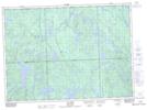
Maps showing Ruisseau Black, Rivière-Kipawa; Témiscamingue, Quebec
Ruisseau Black is a River located in Rivière-Kipawa; Témiscamingue, Quebec.
- Latitude: 46° 56' 45'' North (decimal: 46.9458908)
- Longitude: 78° 0' 40'' West (decimal: -78.0111468)
- Topography Feature Category: River
- Geographical Feature: Ruisseau
- Canadian Province/Territory: Quebec
- Location: Rivière-Kipawa; Témiscamingue
- GPS Coordinate Locator Map: Ruisseau Black Lat/Long
Ruisseau Black NTS Map Sheets