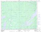
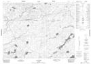
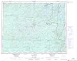
Maps showing Rivière Blaiklock, Baie-James; Jamésie, Quebec
Rivière Blaiklock is a River located in Baie-James; Jamésie, Quebec and has an elevation of 385 meters.
- Latitude: 50° 8' 41'' North (decimal: 50.1447222)
- Longitude: 74° 17' 40'' West (decimal: -74.2944444)
- Topography Feature Category: River
- Geographical Feature: Rivière
- Canadian Province/Territory: Quebec
- Elevation: 385 meters
- Location: Baie-James; Jamésie
- Atlas of Canada Locator Map: Rivière Blaiklock
- GPS Coordinate Locator Map: Rivière Blaiklock Lat/Long
Rivière Blaiklock NTS Map Sheets