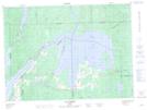
Maps showing Baie Blanchard, Laforce; Témiscamingue, Quebec
Baie Blanchard is a Bay located in Laforce; Témiscamingue, Quebec and has an elevation of 244 meters.
- Latitude: 47° 34' 52'' North (decimal: 47.5811111)
- Longitude: 78° 47' 33'' West (decimal: -78.7925)
- Topography Feature Category: Bay
- Geographical Feature: Baie
- Canadian Province/Territory: Quebec
- Elevation: 244 meters
- Location: Laforce; Témiscamingue
- GPS Coordinate Locator Map: Baie Blanchard Lat/Long
Baie Blanchard NTS Map Sheets