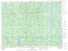
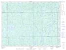
Maps showing Lac du Bois Mort, La Tuque; Le Haut-Saint-Maurice, Quebec
Lac du Bois Mort is a Lake located in La Tuque; Le Haut-Saint-Maurice, Quebec and has an elevation of 460 meters.
- Latitude: 48° 12' 58'' North (decimal: 48.2161723)
- Longitude: 73° 59' 5'' West (decimal: -73.9848411)
- Topography Feature Category: Lake
- Geographical Feature: Lac
- Canadian Province/Territory: Quebec
- Elevation: 460 meters
- Location: La Tuque; Le Haut-Saint-Maurice
- Atlas of Canada Locator Map: Lac du Bois Mort
- GPS Coordinate Locator Map: Lac du Bois Mort Lat/Long
Lac du Bois Mort NTS Map Sheets