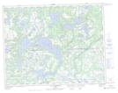
Maps showing Lac Bonnemer, Petit-Mécatina; Minganie, Quebec
Lac Bonnemer is a Lake located in Petit-Mécatina; Minganie, Quebec and has an elevation of 104 meters.
- Latitude: 50° 30' 42'' North (decimal: 50.5117321)
- Longitude: 60° 54' 37'' West (decimal: -60.9103329)
- Topography Feature Category: Lake
- Geographical Feature: Lac
- Canadian Province/Territory: Quebec
- Elevation: 104 meters
- Location: Petit-Mécatina; Minganie
- Atlas of Canada Locator Map: Lac Bonnemer
- GPS Coordinate Locator Map: Lac Bonnemer Lat/Long
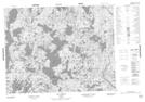
Lac Bonnemer NTS Map Sheets