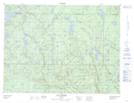
Maps showing Lac du Boomerang, Lac-au-Brochet; La Haute-Côte-Nord, Quebec
Lac du Boomerang is a Lake located in Lac-au-Brochet; La Haute-Côte-Nord, Quebec and has an elevation of 523 meters.
- Latitude: 49° 8' 54'' North (decimal: 49.1483333)
- Longitude: 69° 47' 38'' West (decimal: -69.7938888)
- Topography Feature Category: Lake
- Geographical Feature: Lac
- Canadian Province/Territory: Quebec
- Elevation: 523 meters
- Location: Lac-au-Brochet; La Haute-Côte-Nord
- Atlas of Canada Locator Map: Lac du Boomerang
- GPS Coordinate Locator Map: Lac du Boomerang Lat/Long
Lac du Boomerang NTS Map Sheets