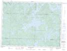
Maps showing Rivière Boucanée, Pohénégamook; Témiscouata, Quebec
Rivière Boucanée is a River located in Pohénégamook; Témiscouata, Quebec and has an elevation of 400 meters.
- Latitude: 47° 30' 13'' North (decimal: 47.5036317)
- Longitude: 69° 17' 5'' West (decimal: -69.2847616)
- Topography Feature Category: River
- Geographical Feature: Rivière
- Canadian Province/Territory: Quebec
- Elevation: 400 meters
- Location: Pohénégamook; Témiscouata
- Atlas of Canada Locator Map: Rivière Boucanée
- GPS Coordinate Locator Map: Rivière Boucanée Lat/Long
Rivière Boucanée NTS Map Sheets