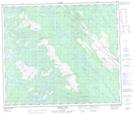
Maps showing Ruisseau Boulder, Lac-Vacher; Caniapiscau, Quebec
Ruisseau Boulder is a River located in Lac-Vacher; Caniapiscau, Quebec and has an elevation of 558 meters.
- Latitude: 54° 59' 11'' North (decimal: 54.9863889)
- Longitude: 67° 5' 29'' West (decimal: -67.0913889)
- Topography Feature Category: River
- Geographical Feature: Ruisseau
- Canadian Province/Territory: Quebec
- Elevation: 558 meters
- Location: Lac-Vacher; Caniapiscau
- Atlas of Canada Locator Map: Ruisseau Boulder
- GPS Coordinate Locator Map: Ruisseau Boulder Lat/Long
Ruisseau Boulder NTS Map Sheets