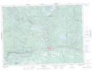
Maps showing Lac Bouleau, Rivière-Kipawa; Témiscamingue, Quebec
Lac Bouleau is a Lake located in Rivière-Kipawa; Témiscamingue, Quebec.
- Latitude: 46° 27' 23'' North (decimal: 46.4563889)
- Longitude: 78° 44' 00'' West (decimal: -78.7333333)
- Topography Feature Category: Lake
- Geographical Feature: Lac
- Canadian Province/Territory: Quebec
- Location: Rivière-Kipawa; Témiscamingue
- GPS Coordinate Locator Map: Lac Bouleau Lat/Long