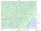
Maps showing Pointe à Bouleau, Betsiamites; Manicouagan, Quebec
Pointe à Bouleau is a Cape located in Betsiamites; Manicouagan, Quebec and has an elevation of 8 meters.
- Latitude: 49° 0' 2'' North (decimal: 49.0005974)
- Longitude: 68° 38' 11'' West (decimal: -68.6364307)
- Topography Feature Category: Cape
- Geographical Feature: Pointe
- Canadian Province/Territory: Quebec
- Elevation: 8 meters
- Location: Betsiamites; Manicouagan
- Atlas of Canada Locator Map: Pointe à Bouleau
- GPS Coordinate Locator Map: Pointe à Bouleau Lat/Long
Pointe à Bouleau NTS Map Sheets