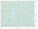
Maps showing Ruisseau Bow, La Tuque; Le Haut-Saint-Maurice, Quebec
Ruisseau Bow is a River located in La Tuque; Le Haut-Saint-Maurice, Quebec and has an elevation of 426 meters.
- Latitude: 47° 47' 37'' North (decimal: 47.7936808)
- Longitude: 74° 43' 1'' West (decimal: -74.7168120)
- Topography Feature Category: River
- Geographical Feature: Ruisseau
- Canadian Province/Territory: Quebec
- Elevation: 426 meters
- Location: La Tuque; Le Haut-Saint-Maurice
- Atlas of Canada Locator Map: Ruisseau Bow
- GPS Coordinate Locator Map: Ruisseau Bow Lat/Long