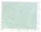
Maps showing Bras des Canots, Mont-Valin; Le Fjord-du-Saguenay, Quebec
Bras des Canots is a River located in Mont-Valin; Le Fjord-du-Saguenay, Quebec and has an elevation of 236 meters.
- Latitude: 48° 34' 48'' North (decimal: 48.5800402)
- Longitude: 70° 52' 57'' West (decimal: -70.8825786)
- Topography Feature Category: River
- Geographical Feature: Rivière
- Canadian Province/Territory: Quebec
- Elevation: 236 meters
- Location: Mont-Valin; Le Fjord-du-Saguenay
- Atlas of Canada Locator Map: Bras des Canots
- GPS Coordinate Locator Map: Bras des Canots Lat/Long
Bras des Canots NTS Map Sheets