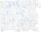
Maps showing Lac Brown, Rivière-Mouchalagane; Caniapiscau, Quebec
Lac Brown is a Lake located in Rivière-Mouchalagane; Caniapiscau, Quebec and has an elevation of 666 meters.
- Latitude: 52° 34' 2'' North (decimal: 52.5672222)
- Longitude: 67° 34' 17'' West (decimal: -67.5713888)
- Topography Feature Category: Lake
- Geographical Feature: Lac
- Canadian Province/Territory: Quebec
- Elevation: 666 meters
- Location: Rivière-Mouchalagane; Caniapiscau
- Atlas of Canada Locator Map: Lac Brown
- GPS Coordinate Locator Map: Lac Brown Lat/Long
Lac Brown NTS Map Sheets