Maps showing Petit lac Brûlé, Lac-Croche; La Jacques-Cartier, Quebec
Petit lac Brûlé is a Lake located in Lac-Croche; La Jacques-Cartier, Quebec.
- Latitude: 47° 38' 37'' North (decimal: 47.6436111)
- Longitude: 71° 56' 41'' West (decimal: -71.9447222)
- Topography Feature Category: Lake
- Geographical Feature: Lac
- Canadian Province/Territory: Quebec
- Location: Lac-Croche; La Jacques-Cartier
- GPS Coordinate Locator Map: Petit lac Brûlé Lat/Long
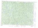
Petit lac Brûlé NTS Map Sheets