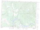
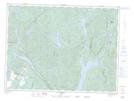
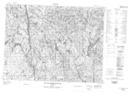
Maps showing Rivière Brûlée, Chute-des-Passes; Maria-Chapdelaine, Quebec
Rivière Brûlée is a River located in Chute-des-Passes; Maria-Chapdelaine, Quebec and has an elevation of 258 meters.
- Latitude: 48° 52' 9'' North (decimal: 48.8691667)
- Longitude: 71° 28' 58'' West (decimal: -71.4827777)
- Topography Feature Category: River
- Geographical Feature: Rivière
- Canadian Province/Territory: Quebec
- Elevation: 258 meters
- Location: Chute-des-Passes; Maria-Chapdelaine
- Atlas of Canada Locator Map: Rivière Brûlée
- GPS Coordinate Locator Map: Rivière Brûlée Lat/Long
Rivière Brûlée NTS Map Sheets