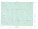
Maps showing Ruisseau Brûlé, Lac-Nilgaut; Pontiac, Quebec
Ruisseau Brûlé is a River located in Lac-Nilgaut; Pontiac, Quebec.
- Latitude: 46° 27' 24'' North (decimal: 46.4567247)
- Longitude: 76° 55' 59'' West (decimal: -76.9330517)
- Topography Feature Category: River
- Geographical Feature: Ruisseau
- Canadian Province/Territory: Quebec
- Location: Lac-Nilgaut; Pontiac
- GPS Coordinate Locator Map: Ruisseau Brûlé Lat/Long
Ruisseau Brûlé NTS Map Sheets