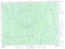
Maps showing Ruisseau Bushkill, La Tuque; Le Haut-Saint-Maurice, Quebec
Ruisseau Bushkill is a River located in La Tuque; Le Haut-Saint-Maurice, Quebec.
- Latitude: 48° 2' 41'' North (decimal: 48.0447710)
- Longitude: 73° 15' 47'' West (decimal: -73.2631695)
- Topography Feature Category: River
- Geographical Feature: Ruisseau
- Canadian Province/Territory: Quebec
- Location: La Tuque; Le Haut-Saint-Maurice
- GPS Coordinate Locator Map: Ruisseau Bushkill Lat/Long
Ruisseau Bushkill NTS Map Sheets