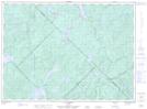
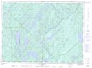
Maps showing Ruisseau du Butor, Lac-Douaire; Antoine-Labelle, Quebec
Ruisseau du Butor is a River located in Lac-Douaire; Antoine-Labelle, Quebec and has an elevation of 357 meters.
- Latitude: 46° 59' 2'' North (decimal: 46.9839474)
- Longitude: 75° 33' 22'' West (decimal: -75.5560286)
- Topography Feature Category: River
- Geographical Feature: Ruisseau
- Canadian Province/Territory: Quebec
- Elevation: 357 meters
- Location: Lac-Douaire; Antoine-Labelle
- Atlas of Canada Locator Map: Ruisseau du Butor
- GPS Coordinate Locator Map: Ruisseau du Butor Lat/Long
Ruisseau du Butor NTS Map Sheets