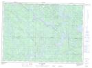
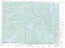
Maps showing Lac Byrd, Lac-Pythonga; La Vallée-de-la-Gatineau, Quebec
Lac Byrd is a Lake located in Lac-Pythonga; La Vallée-de-la-Gatineau, Quebec and has an elevation of 422 meters.
- Latitude: 47° 2' 4'' North (decimal: 47.0344444)
- Longitude: 76° 53' 36'' West (decimal: -76.8933332)
- Topography Feature Category: Lake
- Geographical Feature: Lac
- Canadian Province/Territory: Quebec
- Elevation: 422 meters
- Location: Lac-Pythonga; La Vallée-de-la-Gatineau
- Atlas of Canada Locator Map: Lac Byrd
- GPS Coordinate Locator Map: Lac Byrd Lat/Long
Lac Byrd NTS Map Sheets