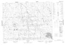
Maps showing Rivière Calamité, La Sarre; Abitibi-Ouest, Quebec
Rivière Calamité is a River located in La Sarre; Abitibi-Ouest, Quebec.
- Latitude: 48° 49' 35'' North (decimal: 48.8264818)
- Longitude: 79° 14' 26'' West (decimal: -79.2406544)
- Topography Feature Category: River
- Geographical Feature: Rivière
- Canadian Province/Territory: Quebec
- Location: La Sarre; Abitibi-Ouest
- GPS Coordinate Locator Map: Rivière Calamité Lat/Long
Rivière Calamité NTS Map Sheets