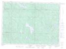
Maps showing Ruisseau Caldwell, Lac-Nilgaut; Pontiac, Quebec
Ruisseau Caldwell is a River located in Lac-Nilgaut; Pontiac, Quebec and has an elevation of 303 meters.
- Latitude: 46° 41' 2'' North (decimal: 46.6839469)
- Longitude: 77° 9' 59'' West (decimal: -77.1663946)
- Topography Feature Category: River
- Geographical Feature: Ruisseau
- Canadian Province/Territory: Quebec
- Elevation: 303 meters
- Location: Lac-Nilgaut; Pontiac
- Atlas of Canada Locator Map: Ruisseau Caldwell
- GPS Coordinate Locator Map: Ruisseau Caldwell Lat/Long
Ruisseau Caldwell NTS Map Sheets