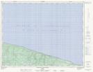
Maps showing Lac Calme, L'Île-d'Anticosti; Minganie, Quebec
Lac Calme is a Lake located in L'Île-d'Anticosti; Minganie, Quebec and has an elevation of 147 meters.
- Latitude: 49° 46' 56'' North (decimal: 49.7822222)
- Longitude: 63° 29' 42'' West (decimal: -63.495)
- Topography Feature Category: Lake
- Geographical Feature: Lac
- Canadian Province/Territory: Quebec
- Elevation: 147 meters
- Location: L'Île-d'Anticosti; Minganie
- Atlas of Canada Locator Map: Lac Calme
- GPS Coordinate Locator Map: Lac Calme Lat/Long
Lac Calme NTS Map Sheets