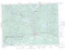
Maps showing Lac Cameron, Rivière-Kipawa; Témiscamingue, Quebec
Lac Cameron is a Lake located in Rivière-Kipawa; Témiscamingue, Quebec.
- Latitude: 46° 28' 1'' North (decimal: 46.4669444)
- Longitude: 78° 37' 21'' West (decimal: -78.6225)
- Topography Feature Category: Lake
- Geographical Feature: Lac
- Canadian Province/Territory: Quebec
- Location: Rivière-Kipawa; Témiscamingue
- GPS Coordinate Locator Map: Lac Cameron Lat/Long