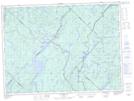
Maps showing Lac du Camp, Lac-Croche; La Jacques-Cartier, Quebec
Lac du Camp is a Lake located in Lac-Croche; La Jacques-Cartier, Quebec.
- Latitude: 47° 36' 41'' North (decimal: 47.6114266)
- Longitude: 72° 4' 13'' West (decimal: -72.0703755)
- Topography Feature Category: Lake
- Geographical Feature: Lac
- Canadian Province/Territory: Quebec
- Location: Lac-Croche; La Jacques-Cartier
- GPS Coordinate Locator Map: Lac du Camp Lat/Long
Lac du Camp NTS Map Sheets