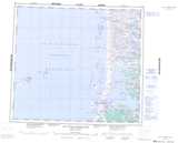
Maps showing Rivière au Caribou, Baie-d'Hudson; Kativik, Quebec
Rivière au Caribou is a River located in Baie-d'Hudson; Kativik, Quebec.
- Latitude: 56° 17' 14'' North (decimal: 56.2872222)
- Longitude: 76° 10' 58'' West (decimal: -76.1827778)
- Topography Feature Category: River
- Geographical Feature: Rivière
- Canadian Province/Territory: Quebec
- Location: Baie-d'Hudson; Kativik
- Atlas of Canada Locator Map: Rivière au Caribou
- GPS Coordinate Locator Map: Rivière au Caribou Lat/Long
Rivière au Caribou NTS Map Sheets