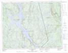
Maps showing Baie aux Caribous, Rivière-aux-Outardes; Manicouagan, Quebec
Baie aux Caribous is a Bay located in Rivière-aux-Outardes; Manicouagan, Quebec and has an elevation of 299 meters.
- Latitude: 50° 1' 39'' North (decimal: 50.0275)
- Longitude: 67° 58' 40'' West (decimal: -67.9777778)
- Topography Feature Category: Bay
- Geographical Feature: Baie
- Canadian Province/Territory: Quebec
- Elevation: 299 meters
- Location: Rivière-aux-Outardes; Manicouagan
- Atlas of Canada Locator Map: Baie aux Caribous
- GPS Coordinate Locator Map: Baie aux Caribous Lat/Long
Baie aux Caribous NTS Map Sheets