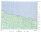
Maps showing Cap Caron, L'Île-d'Anticosti; Minganie, Quebec
Cap Caron is a Cape located in L'Île-d'Anticosti; Minganie, Quebec and has an elevation of 18 meters.
- Latitude: 49° 54' 47'' North (decimal: 49.9130556)
- Longitude: 63° 58' 8'' West (decimal: -63.9688889)
- Topography Feature Category: Cape
- Geographical Feature: Cap
- Canadian Province/Territory: Quebec
- Elevation: 18 meters
- Location: L'Île-d'Anticosti; Minganie
- Atlas of Canada Locator Map: Cap Caron
- GPS Coordinate Locator Map: Cap Caron Lat/Long
Cap Caron NTS Map Sheets