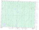
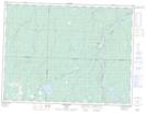
Maps showing Rivière Castagnier, Lac-Despinassy; Abitibi, Quebec
Rivière Castagnier is a River located in Lac-Despinassy; Abitibi, Quebec and has an elevation of 303 meters.
- Latitude: 48° 59' 16'' North (decimal: 48.9877778)
- Longitude: 77° 23' 13'' West (decimal: -77.3869444)
- Topography Feature Category: River
- Geographical Feature: Rivière
- Canadian Province/Territory: Quebec
- Elevation: 303 meters
- Location: Lac-Despinassy; Abitibi
- Atlas of Canada Locator Map: Rivière Castagnier
- GPS Coordinate Locator Map: Rivière Castagnier Lat/Long
Rivière Castagnier NTS Map Sheets