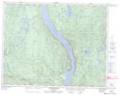
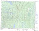
Maps showing Lac Castor, Lac-Jérôme; Minganie, Quebec
Lac Castor is a Lake located in Lac-Jérôme; Minganie, Quebec.
- Latitude: 51° 15' 3'' North (decimal: 51.2508980)
- Longitude: 64° 41' 27'' West (decimal: -64.6907019)
- Topography Feature Category: Lake
- Geographical Feature: Lac
- Canadian Province/Territory: Quebec
- Location: Lac-Jérôme; Minganie
- GPS Coordinate Locator Map: Lac Castor Lat/Long
Lac Castor NTS Map Sheets