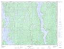
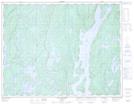
Maps showing Lac Catosca, Rivière-aux-Outardes; Manicouagan, Quebec
Lac Catosca is a Lake located in Rivière-aux-Outardes; Manicouagan, Quebec and has an elevation of 372 meters.
- Latitude: 50° 0' 23'' North (decimal: 50.0063889)
- Longitude: 68° 46' 20'' West (decimal: -68.7722222)
- Topography Feature Category: Lake
- Geographical Feature: Lac
- Canadian Province/Territory: Quebec
- Elevation: 372 meters
- Location: Rivière-aux-Outardes; Manicouagan
- Atlas of Canada Locator Map: Lac Catosca
- GPS Coordinate Locator Map: Lac Catosca Lat/Long
Lac Catosca NTS Map Sheets